|
CROSSLINK is a European research project focused on the efficacy of woody riparian buffers for protecting and enhancing stream and riparian habitats
|
Project Background
|
|
Case studies
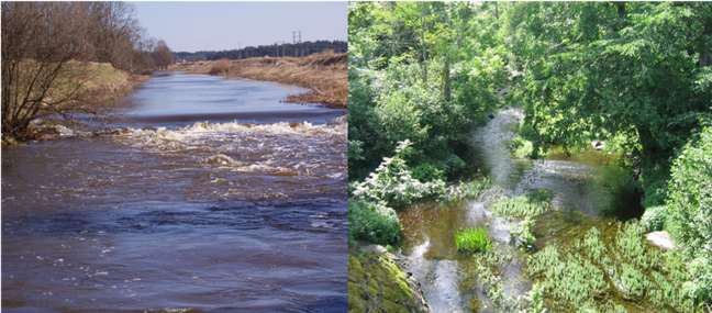
Oslo Basin
|
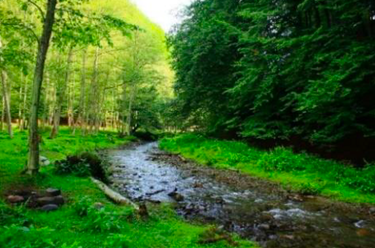
Arges Basin, Carpathian Mountains
|
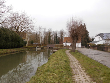
Zwalm catchment in the Scheldt River Basin
|
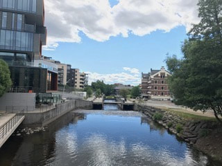
River Fyrisån catchment in the Lake Mälaren basin
|
Project Partners
1) Coordinating institution, Fyrisån catchment: Swedish University of Agricultural Sciences, Uppsala
2) Oslo Basin: Norwegian Institute of Water Sciences (NIVA)
3) Zwalm catchment: University of Ghent, Belgium
4) Arges Basin: University of Bucharest, Romania
5) Optimization framework: Helmholtz-Centre for Environmental Research GmbH (UFZ), Leipzig, Germany
2) Oslo Basin: Norwegian Institute of Water Sciences (NIVA)
3) Zwalm catchment: University of Ghent, Belgium
4) Arges Basin: University of Bucharest, Romania
5) Optimization framework: Helmholtz-Centre for Environmental Research GmbH (UFZ), Leipzig, Germany
Project Funding
CROSSLINK is funded through the 2015–2016 BiodivERsA COFUND call for research proposals. National funders: the Swedish Research Council for Sustainable Development (FORMAS, project 2016-01945) and the Swedish Environmental Protection Agency; The Research Council of Norway (NFR, project 264499); The Research Foundation of Flanders (FWO, project G0H6516N), Belgium; the Romanian National Authority for Scientific Research and Innovation (CCCDI–UEFISCDI, project BiodivERsA3-2015-49-CROSSLINK, within PNCDI III); and the Federal Ministry of Education and Research (BMBF, project FKZ: 01LC1621A), Germany.
Information in local languages
| CROSSLINK Norska.pdf |
| crosslink__på svenska.pdf |
| crosslink_In limba romana.pdf |
| crosslink_Vlaamse taal.pdf |
| crosslink_English.pdf |